
Introduction
This blog post has been spurred on by three years of good questions on local geology (from geologists, paleontologists, and fossil collectors alike) that are difficult to answer easily or quickly. Geology of the Charleston area is quite confusing and dealing with fossil occurrence data here is an equal mix of frustration (when data are insufficient to determine the stratigraphic origin of a fossil) and elation (when the data are sufficient!). Most (but unfortunately, not all) fossil collectors want to know what age their fossil is, which usually requires some knowledge of local stratigraphy, and determining whether or not the fossil is reworked. These are simple questions on the west coast, but are anything but simple here in South Carolina!
This post will be written as much as possible in the vernacular, but stratigraphic/sedimentologic terminology is its own kind of animal, so I’ll add a bit of a glossary right here before we dive in:
Sedimentology: the study of how sediments and sedminetary rocks are formed.
Stratigraphy: the study of rock layers and their ages.
Sedimentation: the process of depositing new sediment; can be expressed as a rate – low sedimentation = slow accumulation; zero sedimentation = no addition of sediment; negative sedimentation = removal of sediment by erosion.
Transgression: sea level rise; Regression: sea level fall. Note: My colleague Steven Holland of U. Georgia reminded me that this is an oversimplification; I've generally used some of my 100 Level Geology class explanations, which usually glosses over some nuanced ideas/definitions. Transgression and Regression are shifts in sedimentary rocks laterally as a result of relative sea level rise/fall - as sea level rises, sedimentary units tracking particular environments (e.g. shoreline sandstones) will shift inwards towards the center of the continent, producing what is called a transgressive sedimentary sequence; when sea level falls, the beaches move out towards the continental shelf, producing a regressive sequence.
Reworking: fossils eroded out of older deposits and deposited into younger deposits.
Phosphate/phosphate rock: a type of rock composed mostly of Calcium phosphate, the same mineral that makes up bones and teeth.
Phosphogenesis: the formation of phosphate-rich sediments in (typically) shallow marine settings.
Phosphatization: enrichment of vertebrate fossils by phosphatic cement.
Nodule: a hard zone of rock that forms from precipitation of a hard mineral (cement) shortly after burial. This is basically the same thing as a concretion.
Lag: a type of bed consisting of large rocks left behind as strong currents removed all of the finer sand and mud sized sediment (e.g. the larger pieces “lag behind”).
Hardground: formerly soft bottom sediments hardened by early mineralization.
In-situ: a fossil still preserved in the rock it was buried in prior to discovery.
Ex-situ: a fossil removed from the rock, found loose on the earth's surface.
Discovering fossils in the Charleston Embayment and the Phosphate Mining Industry
Charleston lies on the South Carolina coast, about halfway between the Georgia and North Carolina borders, at the end of I-26; it’s one of the oldest cities in the south, and was the epicenter of the Civil War; South Carolina was the first state to draft a letter of secession (right in downtown Charleston), followed by the bombardment of Fort Sumter which began the war. Other notable events include the First Battle of Charleston Harbor, the first ‘modern’ naval assault, composed entirely of a squadron of new steam-powered Ironclad ships, and the Second Battle of Fort Wagner, the fateful attack on a Confederate fort on Morris Island by the African American 54th Massachusetts Volunteer Infrantry, depicted in the 1989 film Glory. Charleston is awash in Civil War and Civil rights history – but what does that have to do with paleontology? Quite a bit, as it turns out.

Cuvier's comparison of elephant and mammoth mandibles.
Let’s rewind the clock a little bit to 1725. About 10 miles due west of downtown Charleston (Charlestown at the time) African slaves discovered fossil teeth in the ground at a Plantation called Stono (it’s unclear to me exactly where this is or was, and if it is the same location as the “Stono Rebellion” slave revolt 14 years later). These African slaves, speculated to be from Angola or Congo, unanimously identified these teeth as belonging to modern elephants they were familiar with prior to becoming enslaved. These findings were reported by English botanist Mark Catesby, and many years later (1806) an account of the discovery was published in French by none other than Baron Georges Cuvier. Cuvier specifically noted that the African slaves correctly identified the teeth prior to Europeans in North America. Later in the 18th century, this discovery and others led Cuvier to propose that since 1) teeth of this type of elephant from North America did not match Asian or African elephants, and 2) owing to their gigantic size, explorers were unlikely to discover any further extant species of elephants (he was right), the teeth had to belong to a species no longer existing – leading Cuvier to propose the concept of extinction in a now-famous 1796 lecture. These teeth, and others from eastern North America and Europe would eventually be recognized in the 1790s and early 19th century as representing mammoths. This identification of mammoth teeth by African slaves is now known to represent the first anatomically informed identification of vertebrate fossils in North America. Unfortunately, as with many early discoveries, we don’t really know the whereabouts of these specimens!
A number of discoveries, chiefly from plantations, made during the early to mid 19th century, were reported from the Charleston area. Shark teeth, whale teeth and bones, and land mammal teeth and bones were published in early reports by the likes of Francis Holmes (see below) and others. Holmes was a ‘planter’ – aka landowner with at least a couple dozen slaves – and most of his background was in farming. He amassed a rather large fossil collection, and in 1850 was appointed as curator of the museum at College of Charleston.

Antebellum/pre-phosphate mining fossils from the Holmes collection from the Charleston area; left = Agorophius pygmaeus, an important stem odontocete from the Ashley Formation collected near Middleton Place - evidently collected by Holmes himself with the help of Professor L.R. Gibbes of College of Charleston; to the right - mastodon teeth from various places, published in Holmes (1858/1860). Given that Holmes was a planter, I wonder how man of the other specimens were discovered by slaves digging in the fields. Images from Godfrey et al., (2016: Journal of Paleontology 90:1:154-169) and Holmes (1858/1860).
Fast forward to 1865: General Lee surrenders at Appomattox, the Civil War ends, and the reconstruction era begins (or, begins in 1863 with the Emancipation Proclamation). Former slaves – now freedmen - need work; the numerous plantations in the Charleston area – chiefly in what is now called the famous Ashley River Plantation District (where our apartment is located) – have mostly survived the war, but the labor force for the crops is no longer working “for free”, leaving the plantations in a bit of a financial crisis. At the same time, sharecropping became the new standard for agriculture in the South – which shifted towards less workers per property and smaller farms in general. Prior to the war, some plantations used crop circulation to maintain nutrients in the soil whereas others continued to plant the same crops, depleting nutrients, and planting in different spots on the large properties. Overworking of smaller parcels of farmland by a smaller workforce during Reconstruction led to the realization that fertilizers were needed – bone meal and guano were used before. Phosphate of geological origin was long known from the Charleston area, but not really used for fertilizer yet. In 1869, Professor Francis Holmes, an avid fossil collector (discoverer of the holotype of Agorophius pygmaeus at Middleton Place plantation), early paleontologist, Professor of Geology and Paleontology at the College of Charleston (my institution), and curator of the College of Charleston Museum (now Charleston Museum) – resigned in the wake of wage cuts by the College. He immediately founded the first phosphate mining company in Charleston, ushering in a new economic era.

Geologic map of the Charleston area - salmon-red colored areas are phosphate spoils (map symbol "ps"). Charleston itself is the southern end of that peninsula next to Charleston Harbor.
From Weems et al. 2014.
Plantations in the Ashley River region were quickly found to have abundant phosphate deposits underlying them. These plantations are located in an area about 5-10 miles west northwest of downtown Charleston in the West Ashley area (where I live) between I-526 and Middleton Place plantation and in North Charleston and Summerville along the north bank of the Ashley River and around the Charleston airport and joint air base. Over the next twenty years, these plantations permitted phosphate mining on their former farmland as an opportunity to make some money. Most of the phosphate mines were hand-dug by freedmen, oxen, and horses with ploughs. Phosphate processing semi-industrialized, but the excavation process still revolved around manual labor and the use of livestock; most phosphate deposits were under 10 feet of overburden (small fry for later steam-powered equipment like steam shovels, but quite a lot of sediment to move by hand). The “crude phosphate” – phosphatic nodules and pebbles – were dug out and moved by wheelbarrow or conveyor belt to a steam powered washing house where sand and clay would be washed off the nodules. These clean nodules would later be treated with sulfuric acid to produce phosphoric acid (the purest form of phosphate fertilizer), although crushed phosphate rock was occasionally used as well for fertilizer. [Limestone can be used as fertilizer as well, but is less nutrient rich; in New Zealand, Otekaike Limestone from Hakataramea Quarry (type locality for many marine mammals like Otekaikea huata, Toipahautea waitaki, and Horopeta umarere, and the billfish Aglyptorhynchus hakataramea) was an agricultural lime quarry.] In 1870, phosphate deposits in the Ashley, Stono, Cooper, and Wando rivers were also excavated as they were typically right at the river bottom and could easily be dredged by barges; many piles of fossil-rich sediment discarded by these barges line the edges of the Lowcountry rivers today.
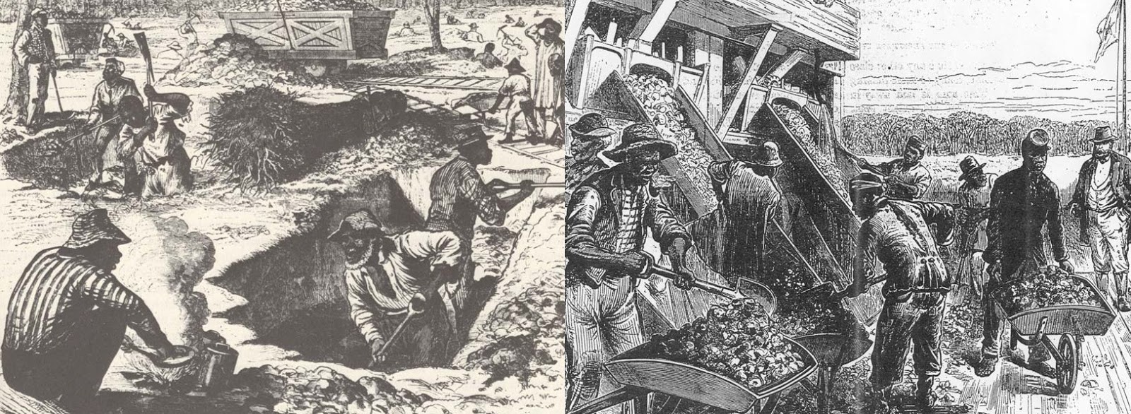
Phosphate miners digging (left) and loading (right) phosphate into mine cars.
From Shuler and Bailey (2004).

For reasons I will explain below, vertebrate fossils tend to occur wherever phosphatic nodules are common, and many additional vertebrate fossils were discovered during the Reconstruction-era phosphate industry. By the 1880s, South Carolina produced half of the world’s phosphate. The industry was hit hard by the 1886 earthquake (7.0 magnitude, give or take) and a category 3 hurricane the same year; at the same time, more economically viable phosphate was discovered in the Bone Valley phosphate district in Florida; Florida phosphate remains the largest deposit in the USA, and is still mined today. All that remains today of the Charleston phosphate boom are low hills and parallel ridges in the Ashley River region, now completely re-vegetated; such curious topography is visible today in West Ashley Park just a few minutes’ walk from my apartment.
A brief introduction to the stratigraphy of the Charleston Embayment
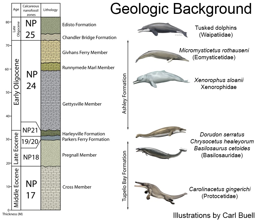
The Charleston Embayment is a geological term referring to a thickening of sedimentary rocks on the central South Carolina coast. In deposits of the Atlantic Coastal Plain, the strata thicken in embayments and tend to extend further inland and are separated by “arches” – somewhat uplifted regions where the strata thin towards. The Charleston embayment transitions to the Cape Fear Arch in the area around Wilmington, North Carolina, and to the north lies the Albemarle Embayment where the famous phosphate deposits of the Lee Creek mine were deposited (the Salisbury embayment in Virginia and Maryland hosts the famous Calvert Formation). Deposits in the Charleston embayment are Cenozoic (65 million years or younger) and typically marine. There are some laterally discontinuous Paleocene deposits with fossils, but the story really begins in the Eocene. Close to Charleston, Eocene deposits include the lower Eocene Fishburne Formation (the only well-published Eocene shark assemblage in South Carolina), the Santee Limestone (mid Eocene), the Cross and Pregnall members of the Tupelo Bay Formation (mid and late Eocene, respectively), and the Cooper Group: the thin Harleyville and Parkers Ferry formations (late Eocene).

Paleogene stratigraphy of the South Carolina coastal plain.

Holotype skull and teeth of Chrysocetus healyorum, a small basilosaurid from the Eocene of Harleyville, SC. From Uhen (2013: Alabama Museum Bulletin 31:2:1-45).
Eocene deposits are not exposed close to the coast, and typically not in river deposits either. Most Eocene fossil localities are in a series of quarries in the Harleyville-Orangeburg area; these quarries are cement quarries, such as Giant Portland Cement quarry in Harleyville. Fossil sharks, bony fish, giant sea snakes (Palaeophis), sea turtles and archaeocete whales are often encountered in these quarries and many have made their way into the Charleston Museum, South Carolina State Museum, and my own museum, the Mace Brown Museum of Natural History. Protocetids (four-legged oceangoing whales, the first to arrive in North America) can be found in the oldest beds, including the aptly named Carolinacetus gingerichi, named in 2005 by my colleague Jonathan Geisler from Cross Quarry. Other protocetids from these same quarries are currently in the process of being researched. The younger deposits have produced basilosaurid whales like Basilosaurus sp., Cynthiacetus sp., the tiny Chrysocetus healyorum, and the original species of Dorudon, Dorudon serratus. Shark teeth desired by collectors from the Eocene include the tiny Hexanchus agassizi, Hemipristis curvatus, and the early megatoothed shark Carcharocles auriculatus. Teeth of reef sharks (Carcharhinus spp.) are super abundant. Though widely bought and sold, mid-late Eocene sharks are almost completely unpublished from South Carolina.
The oldest sedimentary unit in the Charleston phosphate area itself is Oligocene in age, and the uppermost unit of the Cooper Group: the Ashley Formation. The Ashley Formation, or Ashley limestone informally, is about 20+ meters thick, and composed of olive-tan sandy limestone with occasional greensand; the base of the unit contains a phosphate lag. This is the thicker of the two Oligocene units in the area; it is overlain by the patchy and thin (one meter at most) Chandler Bridge Formation. Both units are richly fossiliferous, but the Chandler Bridge is famous for its shark teeth. A large assemblage of fossil sharks, bony fish, sea turtles, crocodilians, sea birds, sea cows, and early ‘modernized’ whales (Odontoceti, echolocating whales, and Mysticeti, baleen whales) is known from these two units. Common sharks include reef sharks (Carcharhinus spp.), tiger sharks (Physogaleus/Galeocerdo), snaggletooth sharks (Hemipristis serra), the strange devil ray Plinthicus, the earliest record of whale sharks (Rhincodon), cow sharks (Rhinoptera), and of course the highly sought after megatoothed shark Carcharocles angustidens (lovingly nicknamed ‘angies’ by locals).
A slide from one of my presentations showing the difference in middle Eocene, Late Eocene,
and Oligocene whale faunas and an Eocene-Oligocene stratigraphic column.

A partial carapace of a sea turtle in the Oligocene Ashley Formation, Summerville, SC,
excavated in November 2017 with permission from the city of Summerville. Photo by RWB.
There’s about a four-million-year gap between the Ashley and the Parker’s Ferry Formations, during which time archaeocete whales, pycnodont fish, and giant sea snakes became extinct; simultaneously, echolocating whales and baleen whales arose (topics I’ll cover in depth later). The most obvious changes in the whale fauna are a sharp decrease in the minimum size of whale teeth and bones: some whales (e.g. Coronodon, Eomysticetus, “Genus Y”) maintain the body size of larger archaeocetes but many new odontocete dolphins are quite tiny, with the smallest cetacean to ever evolve originating from the Ashley Formation (the xenorophid dolphin Inermorostrum, which I named last year). Most of the well-preserved fossil cetaceans (and virtually everything collected in situ) hails from these two units. Another Oligo-Miocene unit, the Edisto Formation, has been the source of some confusion in the literature and it is unclear if any vertebrate fossils originate from it – it will not be considered further.
Another 6 million year gap is present above these Oligocene beds, and the next unit is the approximately 18 million year old (lower Miocene) Marks Head Formation. No surficial exposures of this unit are known in the Charleston area, and it is much better known further south in Georgia. Based on auger holes, the Marks Head is up to 15 meters thick and consists of olive gray-olive brown phosphatic sand. Occasionally fossils of “kelloggitheres” like baleen whale Parietobalaena can be found rarely (typical from the early-mid Miocene, like the Calvert Formation of Maryland), as are rare teeth of the megatoothed shark Carcharocles chubutensis (nicknamed “chubbies” by locals). These are always found ex situ, as the Marks Head is only present in the subsurface and only under the sea islands; it tapers inland and is not present in the subsurface any further inland than James Island or Downtown Charleston. Teeth of C. chubutensis found in Summerville are likely reworked into Pleistocene deposits (keep reading!).
Some rare middle-late Miocene fossils have been discovered, such as a gigantic kentriodontid dolphin (cf. Hadrodelphis) on display at the Aurora Fossil Museum, from an unspecified locality in the Charleston area. A possible latest Miocene locality exists on the Ashepoo River, and there are cetaceans with affinities to those from the lower Bone Valley Formation (late Miocene – e.g. Pomatodelphis) known from the lowcountry. These localities, however, are poorly understood and we do not really understand the geology as the fossils were collected without geologic data.

A typical Pliocene fossil - a lower tooth of the great white shark Carcharodon carcharias, likely from the Goose Creek Limestone, found in February 2018 in a puddle at Folly Beach, SC. Photo by RWB.
Thousands of pebbles and cobbles of the Pliocene Goose Creek Limestone littered
Folly Beach in February 2017. Photo by RWB.
Pliocene deposits are quite abundant in the Charleston area and exposed at the surface and subsurface. The Goose Creek Limestone is essentially equivalent in age with parts of the famous Yorktown Formation of North Carolina, and 3-4 million yeas in age. The Goose Creek Limestone is a gray, porous shell-rich sandy limestone up to 15 meters thick. There are few surficial exposures, but it is the source of the much maligned gray rocks on Folly Beach that turned up after the 2014 beach renourishment project. Recent efforts by CCNHM paleontologists (e.g. Sarah and I) and museum volunteer Ashby Gale, along with donations of many many private collectors, have established quite a large collection of specimens of probable origin from this unit. The shark assemblage is quite similar to the Yorktown Formation of North Carolina and includes Galeocerdo cuvier (much larger than Oligocene Galeocerdo), reef & lemon sharks (Carcharhinus, Negaprion), snaggletooth sharks (Hemipristis serra), sand tiger sharks (Odontaspis/Carcharias), ancient mako (Carcharodon hastalis) and great white sharks (Carcharodon carcharias), as well as the coveted Carcharocles megalodon. Most of these are known from specimens with adhering matrix – some are not, and could potentially be Pleistocene in age (but unlikely, given that most of the Pleistocene deposits are terrestrial – but keep reading!). Phosphate nodules are common within the Goose Creek Limestone. The Raysor Formation is a similar Pliocene unit, exposed in some quarries in the Harleyville area, but does not yield many vertebrates.

Age correlation of various Pleistocene units in the Charleston area, from Sanders (2002).
There are a number of Pleistocene units, several of which have yielded diverse vertebrate assemblages; these are, from oldest to youngest, as follows: Waccamaw Formation (late Pliocene-early Pleistocene), Penholoway Formation (middle Pleistocene), Ladson Formation (middle Pleistocene), Ten Mile Hill Formation (middle Pleistocene, Wando Formation (late Pleistocene), and the unnamed Edisto Beach deposit (late Pleistocene). These units are predominantly unconsolidated (soft) and thin – up to 10 meters, but rarely more than a couple of meters thick (each). Aside from a few specimens found in Pliocene marine rocks like a Borophagus dog tooth from the Goose Creek Limestone at Cross Quarry and possible records of the giant capybara Neochoerus pinkneyi from the same unit along the Ashley River (the holotype, to be precise), nearly all land mammal fossils from the Charleston area derive from these units. Fossils of mammoths, mastodon, camels, horses, tapirs, peccaries, deer, moose, bison, carnivores, porcupines, capybaras, giant beavers, armadillos, glyptodonts, and ground sloths have all been reported from the Charleston area; a well-known monograph by Al Sanders (2002) can be consulted for further details. The youngest well-sampled marine vertebrate-bearing unit is part of the Waccamaw Formation in the Ridgeville area in a couple of sand pits, and has yielded a diverse assemblage of 50+ sharks, fish, marine mammals, and “accidentally preserved” terrestrial reptiles and mammals (our first paper on this fauna is currently in press in Acta Paleontologica Polonica, so stay tuned).
One of these units, the Wando Formation (~130,000-70,000 years old) has been identified as the probable source of economically significant phosphate deposits; the basal bed of the Wando Formation includes a 30 cm thick lag deposit of phosphate. Other Pleistocene units have basal phosphatic lags and are shallow enough to dig down towards by hand. However, in the Ashley Phosphate mining district, most of the surrounding undisturbed beds adjacent to the mined areas appear to correspond to the Wando Formation – and miners dug straight down to the contact with the Ashley Formation. In places, the Ten Mile Formation is adjacent to the phosphate spoils, so perhaps this unit was also mined.
What is phosphate rock and how does it form?
Phosphate is a rock composed of Calcium phosphate – the mineral apatite. Calcium fluorapatite is the specific type that makes up vertebrate bones and teeth. Phosphorus is present in all organisms and a critical component of many life sustaining molecules. Microbial decomposition of animal carcasses at the seafloor (invertebrates and vertebrates alike) will free up phosphorus which becomes dissolved in sea water; this often gets buried in deep sea deposits along with fish bones, considered to be a significant source of temporarily buried phosphate. Upwelling currents (in the Cenozoic of the North Atlantic, most common from the Oligocene onwards resulting from the new current regime driven by setup of the circum Antarctic Current) bring phosphate and nutrient rich water to the surface, with two principal effects: 1) shallow marine water is abnormally enriched with phosphorus, permitting shallow water phosphogenesis, and 2) local nutrient blooms allowing for localized explosions in animal biomass. An example of this is the incredibly rich and diverse marine fauna of Monterey Bay, California – an upwelling zone.

A model of phosphate formation and concentration from Follmi (1996).
Phosphogenesis is the process of forming phosphate rock. It generally requires upwelling to provide an influx of phosphorus, but generally only progresses if sedimentation rate is low or zero (e.g. no sediment is being deposited over long periods of time – tens to hundreds of thousands of years). This can be accomplished in a few ways, but the most common way is during a change in sea level…change (e.g. going from rising to falling or vice versa). During an initial sea level rise, the ocean will invade all of the coastal rivers and form estuaries which trap sediment far inland from the coastline, otherwise known as sediment starvation. On the Pacific and Atlantic coasts, many transgressive deposits (e.g. marine deposits made during periods of sea level rise) have a basal phosphatic lag.
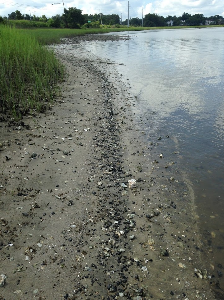
A strandline of black phosphate nodules on the bank of the Ashley River. These are from dredged sediment dumped at the base of what is now the Cosgrove Bridge in West Ashley, and these and vertebrate fossils slowly erode out of the man-made dredging deposit. Photo by RWB.
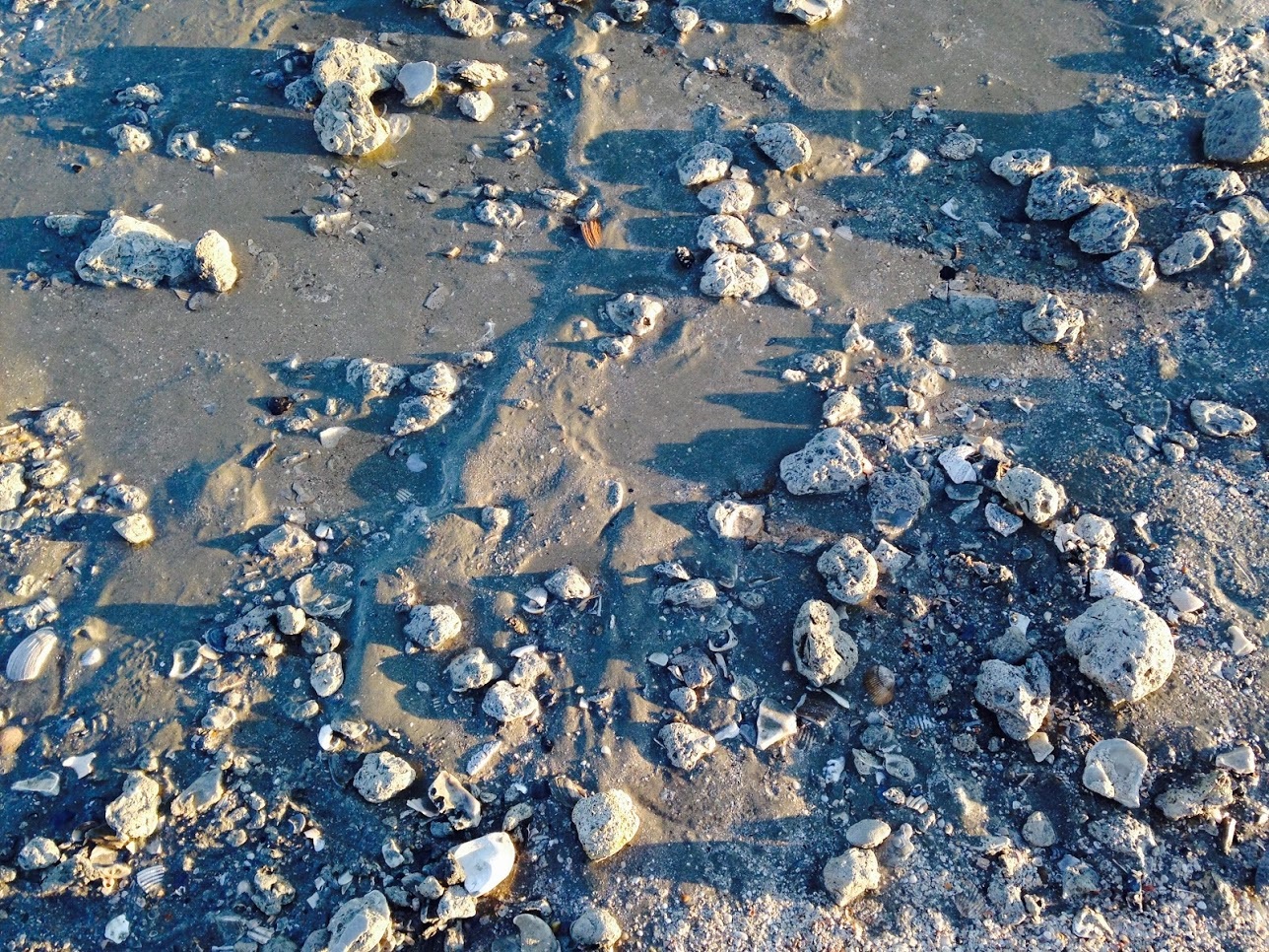
Phosphate nodules and phosphatic hardgrounds form by the precipitation of phosphatic cement in pre-existing sediments, often limestone or mudrocks, and occasionally sandstones. Phosphate tends to be precipitated as the mineral francolite, under the seafloor at the boundary between oxic and anoxic pore water, directly on the edges of mineral grains, on shells, and especially within the pre-fabricated three-dimensional lattice “scaffold” made of the same mineral – vertebrate bone. Depending upon the rate of phosphate precipitation below the seafloor (usually no less than a meter below the seafloor) or the length of precipitation, nodules can grow to quite large sizes. Exposed limestone can become phosphatized and form crusts or phosphatic hardgrounds, which if subsequently eroded away will form sheetlike fragments of phosphate. Most phosphate rock in the Charleston region (and on the west coast) consists of nodules of phosphate cemented mudrock that have been reworked into a younger unit (although the intensely-studied Monterey Formation in California is a bit different). Phosphatic beds are typically formed as thin (5-30 cm thick) conglomeratic lag deposits; phosphate nodules in the Ashley Phosphate beds are usually All told, phosphate rich beds tell a story of nonsedimentation and erosional concentration forming lag deposits.
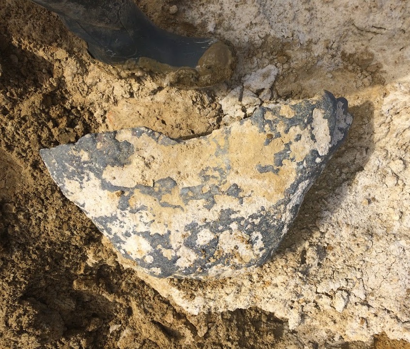
The largest phosphate nodule I've ever seen in the field - a 100 pound block measuring over half a meter wide - and it is broken! Plio-Pleistocene Waccamaw Formation, Ridgeville, SC. Photo by RWB.
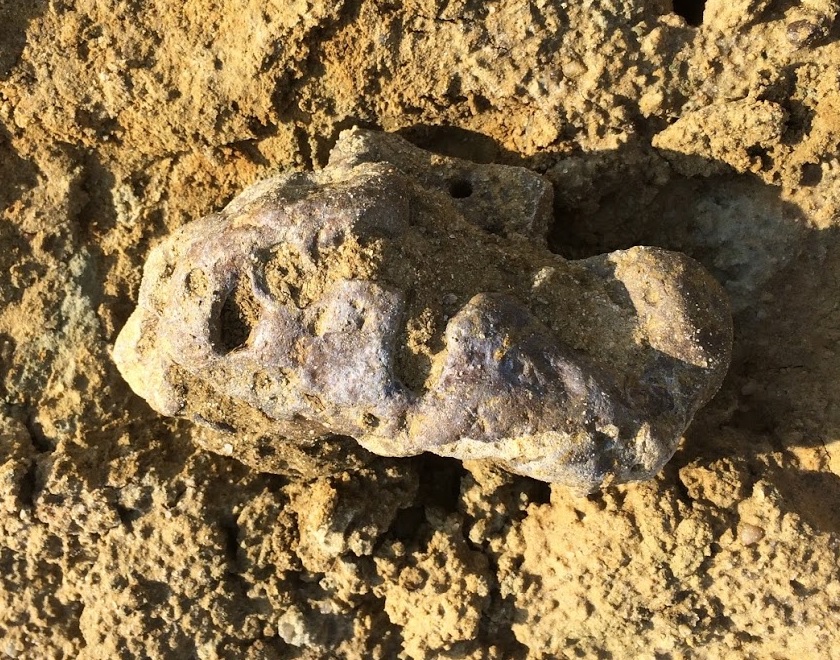
Another huge nodule, but not quite as absurd as the one before. This has a series of irregular cavities and pits, and is more typical in shape. This is about 20 cm wide. Same locality. Photo by RWB.

Collecting phosphate nodules from the seafloor - Chatham Rise, NZ. Mostly Miocene and Pliocene nodules, and fossil sharks and cetaceans have been reported from these dredgings.
Photo from rockphosphate.co.nz.
But what is the source of the phosphate? Most of the phosphate in the Ashley Phosphate Beds is reworked – meaning it was eroded out of preexisting rocks. Fortunately, molds of invertebrates are quite common in the phosphatic nodules (especially at places like Northbridge Park in West Ashley) and most of the invertebrate discovered in the nodules are present in the lower Oligocene Ashley Formation – which also happens to directly underlie the phosphate mining spoils and trenches in the mining district. One of the great examples I have found, overlooked by earlier geologists, is the common solitary coral Balanophylla – which is present in many phosphate nodules, and commonly preserved in the Ashley Formation. A purported “shark-bitten coprolite” with an embedded Carcharocles angustidens tooth which recently made the rounds on social media had one of these solitary corals inside (misidentified as a “dermal denticle” of a stingray), clearly identifying its origin as a piece of phosphatized Ashley limestone.
Phosphogenesis and fossil preservation: why should we care?
The conditions that lead to phosphogenesis just happen to do some wonderful things for vertebrate fossils. First off, phosphogenesis leads to the precipitation of phosphatic cement – the process of phosphatization leads to very heavy and densely mineralized fossils, substantially increasing their preservation potential. Secondly, phosphogenesis is often accompanied by low, zero, or negative sedimentation (remember negative = erosion). One major tenet of marine taphonomy is that fossil-rich beds (a layer of sediment with a higher proportion of fossils than layers above/below) can be produced in two ways: 1) a temporary boom in the number of live animals, resulting in a pulse of skeletal material; and 2) a temporary slowdown in sedimentation, increasing the relative abundance of skeletal material to sediment (more bones per unit sediment).

Formation of bonebeds by nondeposition and erosion. From Boessenecker et al. (2014).
Simple math problem: Let’s say the typical sedimentation rate of new sedimentary rock is one vertical meter per 100,000 years (so a sheet of sediment one meter thick every 100,000 years). During this sedimentation rate, on average there will be one bone for every square meter produced in each new 100,000 year 1-meter thick “sheet”. If we slow that sedimentation rate down to 10 cm per 100,000 years (but keep fossil accumulation rate steady), we then produce a 10cm thick layer of sediment with the same number of bones per square meter. All of a sudden this thinner, more slowly deposited layer only 10cm thick has the same number of bones per unit time, but with only 10% of the sediment – roughly a 9-10 fold increase in the abundance of fossils per volume sediment. Because fossils are often difficult to spot if they are only rarely preserved, I suspect the chance of discovery increases exponentially as sedimentation rate decreases linearly. This simple relationship means that any time there is a slowdown in sedimentation rate, bonebeds (or shellbeds) can form. This is perhaps easier to determine in the rock record than actually measuring differences in biomass, so taphonomists tend to prefer a purely geological explanation like this.
So far I’ve only discussed slower deposition. Let’s say we stop sedimentation altogether for one million years – no new sediment is being deposited at all. Critters are still living in the water column though – and dying. After one million years, ten bones per square meter have no been deposited on the seafloor without any new sediment – a huge spike in the fossil:rock ratio. Bonebeds and shellbeds formed by zero net sedimentation are also quite common.
I studied phosphatization of fossils from the Purisima Formation on the west coast for my master's thesis. Left: a qualitative way to assess the two aspects of phosphatization (replacement/enrichment of the tissue with phosphatic cement) and formation of nodules or phosphatic overgrowths). On the right: relationship between different kinds of damage (abrasion, fragmentation, polish) with phosphatization (this doesn't necessarily tell us much about the long-term survivability, but may suggest that phosphatized fossils are likely to sit around for a long time and incur minor damage with little effect on long term preservation). From Boessenecker et al. (2014).

Lastly, phosphogenesis is usually associated with somewhat acidic porewater that often results in the dissolution of calcium carbonate shells, particularly the mineral aragonite. Invertebrates are often completely dissolved away, leaving internal molds, like steinkerns – the internal molds of clams, which in the Charleston embayment are almost always phosphatic. Molds of clam shells or corals (mentioned above) are often found inside phosphate nodules. Despite invertebrate skeletal elements being vastly more common than vertebrates, they are rare in the Ashley Phosphate beds because they have been dissolved away – a classic example of a “chemical lag” where the more soluble material has been dissolved. So there are multiple processes occurring in Charleston: mineralization of vertebrate fossils, dissolution of shells, reworking, and concentration of fossils and phosphate nodules into rich phosphate lag deposits.
Stratigraphic Confusion in the Carolina Lowcountry
This all leads back to the simple question “How old is my fossil?” My first question is “where is it from?” If you can’t remember and do not record field notes, then you had better read my blog posts on field notes. If you can answer that question, my second question is “what layer is it from?” This is admittedly a more difficult question if you are an amateur fossil collector with limited exposure to geology – in which case I am happy to help. If it was collected from a bonebed like the so-called “meg layer” here in Charleston (in reality, up in Summerville this is the basal phosphatic lag in the Wando Formation), then it could be from any time period from which the fossils are reworked. In which case the identification of the specimen is our only clue – if it is a Carcharocles angustidens tooth, we know that is an Oligocene-only taxon, and therefore likely from the Ashley or Chandler Bridge formation. If from Hemipristis serra, it is probably from the Pliocene Goose Creek Limestone. If a giant beaver Castoroides, then one of the Pleistocene units. Bison is late Pleistocene only, so probably only from the Wando Formation. If a particular fossil type is long-ranging, such as teeth of reef sharks (Carcharhinus), then it could be from any Oligocene, Miocene, Pliocene, or Pleistocene deposit (unlikely for the latter since the Pleistocene verts are typically all terrestrial).

Part of a cross-section (click to embiggen) of the Charleston area parallel with the shoreline, going through Folly Beach SC, highlighting the lensoidal geometry of many rock units that thicken and pinch laterally. Units of note: Pa = Ashley Formation; Nmh = Marks Head Formation; Ngc = Goose Creek Limestone; Qwf = basal Wando Formation; af= artificial fill. From Weems et al. (2014).
Adding to this confusion is the fact that there is virtually no topographic relief in the Carolina lowcountry (hence the name) and because everything is so damned close to sea level, you will never see more than 1-2 meters of the stratigraphic section. Therefore, there is no single place where you can see all of the rock layers listed above exposed at the earth’s surface. These layers are also thin and variable in thickness; they pinch and swell in three-dimensions underground, meaning that they have a lens-shaped geometry in the subsurface. If you trace a layer laterally, it will terminate against older layers. Some units are naturally quite thin and patchy like the Chandler Bridge Formation, which seems to have simply filled in preexisting low areas and then stopped at a maximum thickness of three meters.
As a result of all of this, the most scientifically significant fossils are those that were collected in situ from sediment rather than ex-situ. If you collect a fossil in situ, but do not keep a sediment sample, or do not record the location, depth, and a description of the rock, the scientific significance of the fossil is greatly diminished! Always record field notes and keep sediment samples!
Conclusion
The take home messages of this overly-long writeup are as follows:
1) Charleston has a long and rich history of vertebrate paleontology that is surprisingly interwoven with the history of slavery in Antebellum South Carolina and the short-lived economic boom of the Reconstruction-era phosphate mining industry. Many fossils were found in Charleston before the Civil War (likely on accident by slave labor) but the pace of discoveries exploded during the 1870s and 1880s by phosphate mining activities on land and by river dredging.
2) The Charleston embayment hosts a rich sequence of Cenozoic fossil assemblages, each unit with its own unique fauna. Within the Charleston area, these are Oligocene to Pleistocene in age. The most densely sampled assemblages are the oldest and the youngest – rich Oligocene marine vertebrate assemblages including the oldest echolocating dolphins and baleen whales, and scattered but numerous land mammals, alligator, and turtles from various Pleistocene deposits.
3) Phosphate is a commonly preserved economic resource in the Charleston area, and is formed by upwelling and concentrated by low/zero/negative sedimentation rates.
4) Phosphogenesis tends to concentrate vertebrate bones and teeth while often dissolving calcium carbonate, meanwhile reinforcing the already-present calcium phosphate in bones and teeth with more phosphatic cement. These factors explain why bones and teeth are often found in conjunction with phosphate nodules. Fossils in the Charleston area are often reworked into younger rocks (as are phosphate nodules).
5) Charleston stratigraphy is complicated and difficult to interpret in the absence of drilling auger holes and examining rocks in the subsurface.
6) As a result of all of this, make sure you keep detailed locality notes for anything you collect in-situ!
See also:
Further Reading & Bibliography (Open access links provided).
Föllmi, K.B. 1996. The phosphorus cycle, phosphogenesis and marine phosphate-rich deposits. Earth Science Reviews 40:55-124.
Holmes, F.S. 1858/1860. Post-Pleiocene fossils of South Carolina. Russell and Jones, Charleston. 122pp.
Holmes, F.S. 1858/1860. Post-Pleiocene fossils of South Carolina. Russell and Jones, Charleston. 122pp.
Malde, H.E. 1959. Geology of the Charleston phosphate area,South Carolina. USGS Bulletin 1079:1-105.
A. E. Sanders. 2002. Additions to the Pleistocene Mammal Faunas of South Carolina, North Carolina, and Georgia. American Philosophical Society 1-152